Irishtown Bend Hillside Stabilization
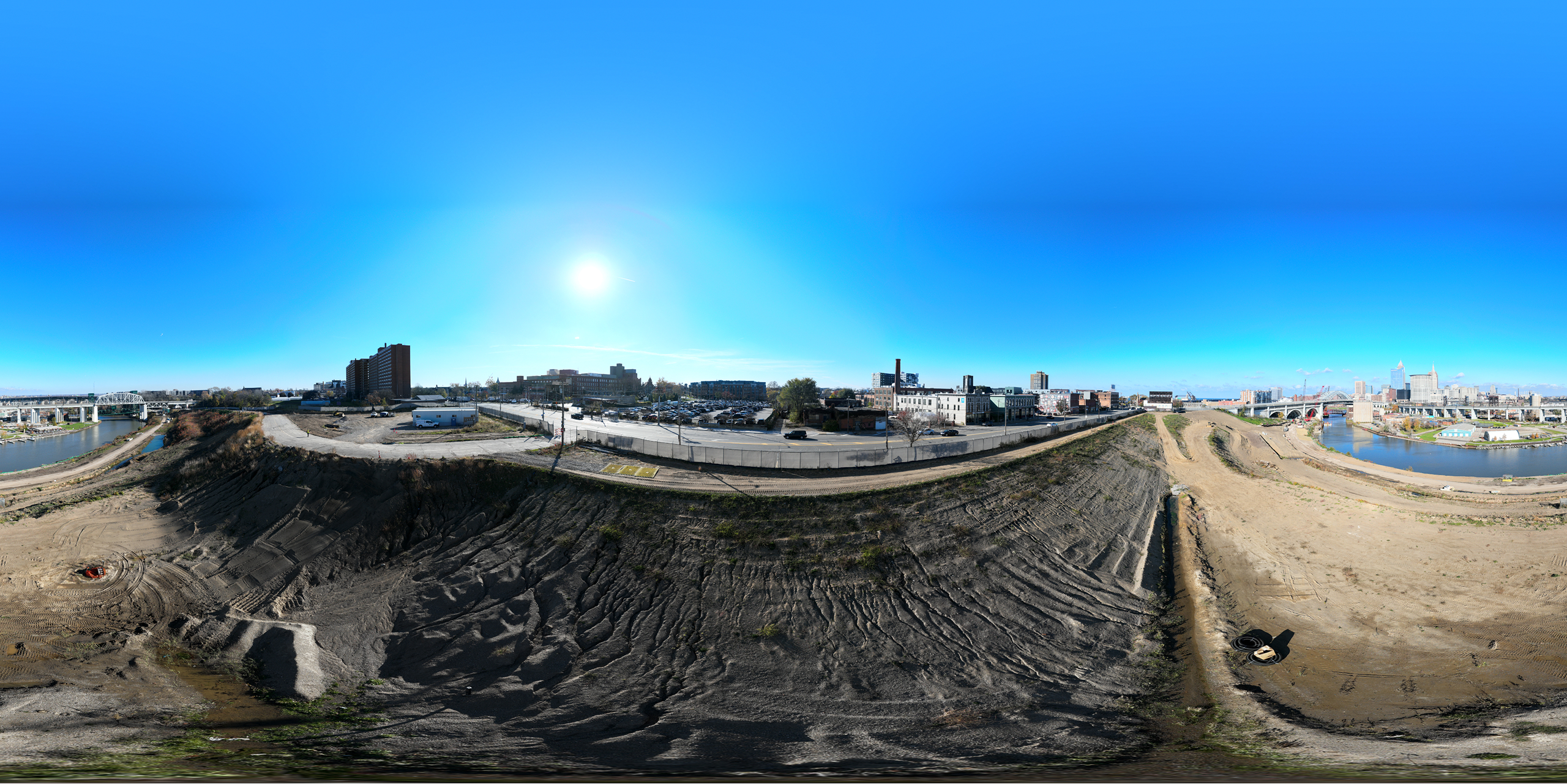
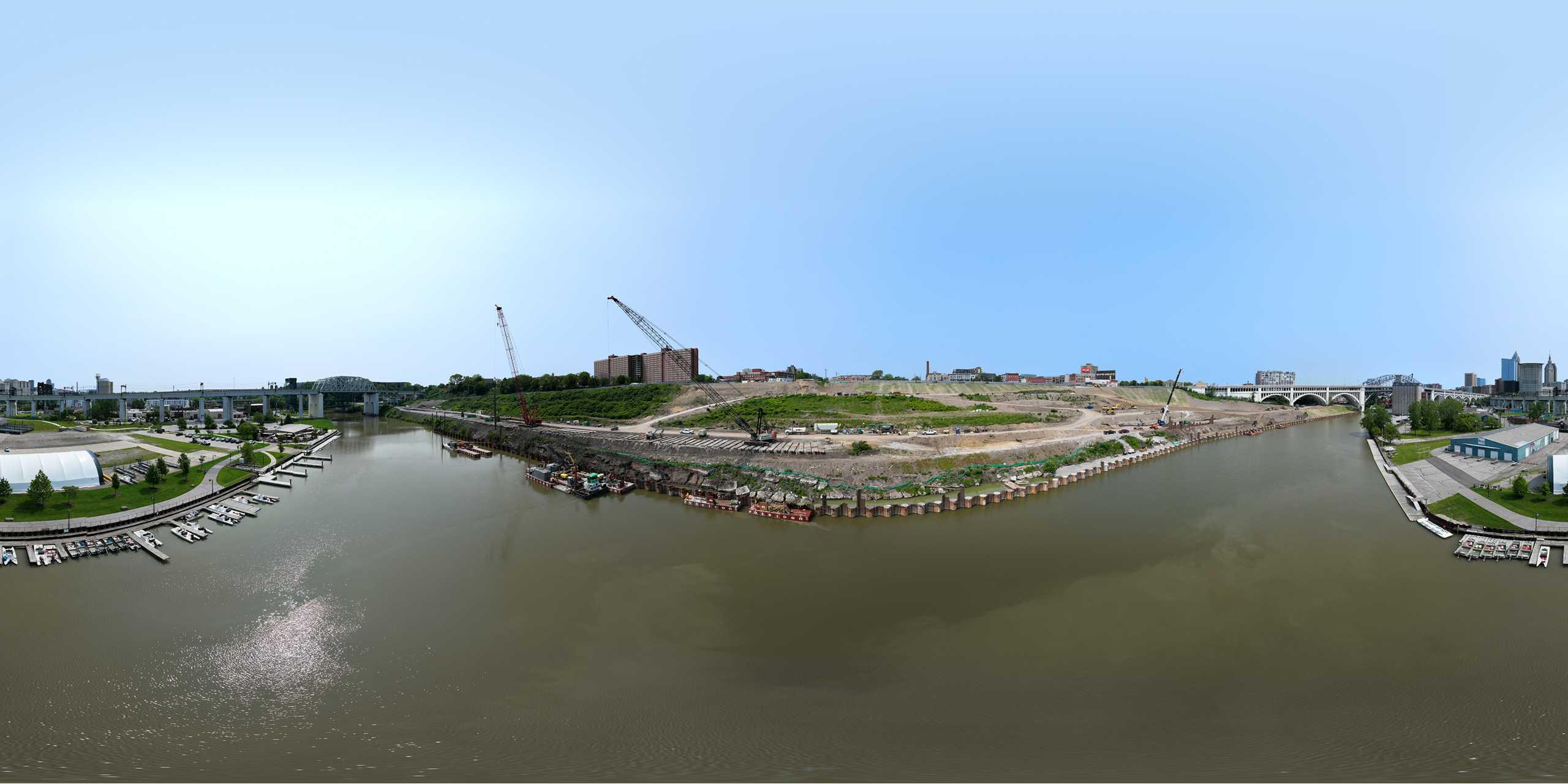
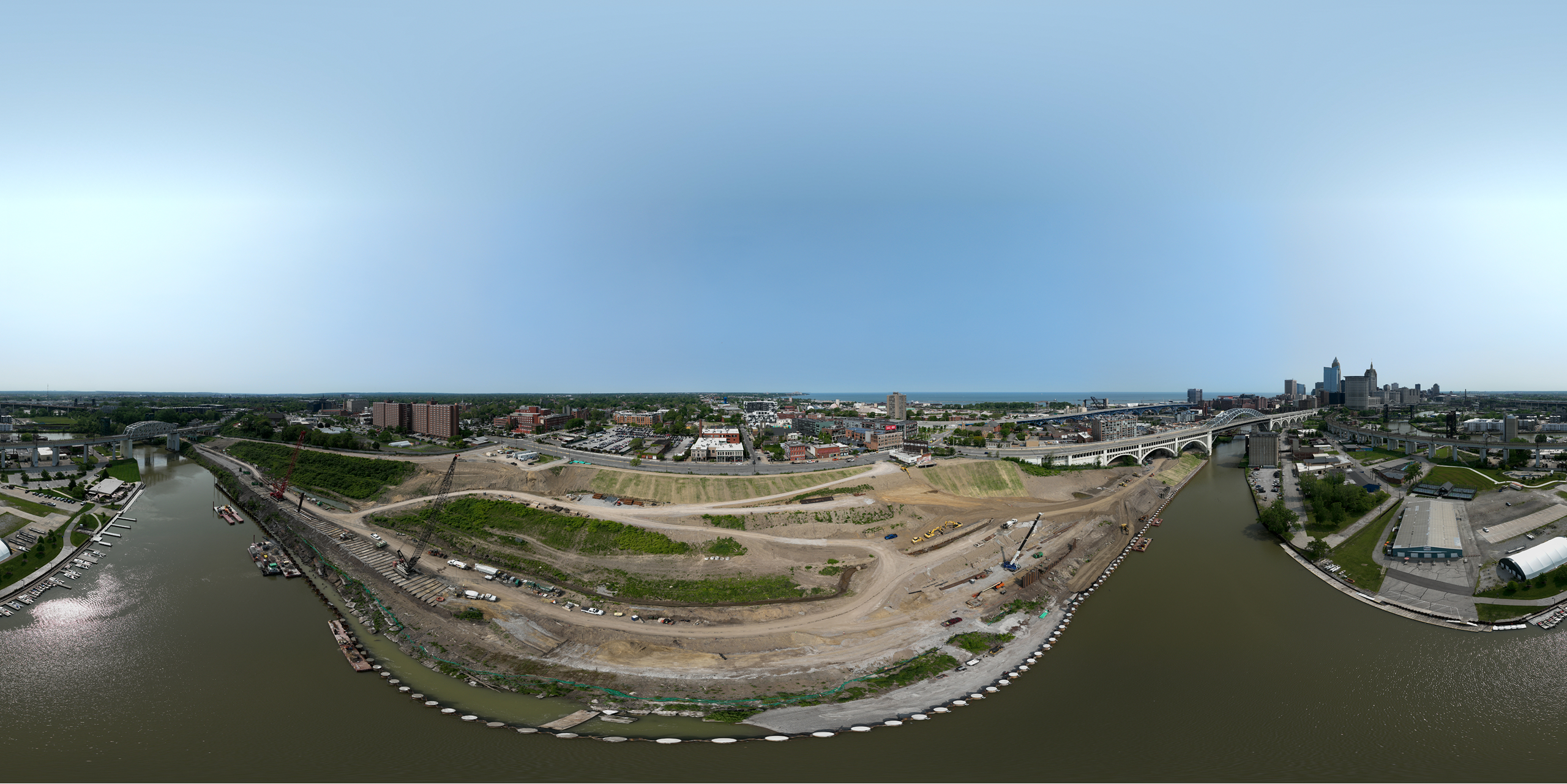
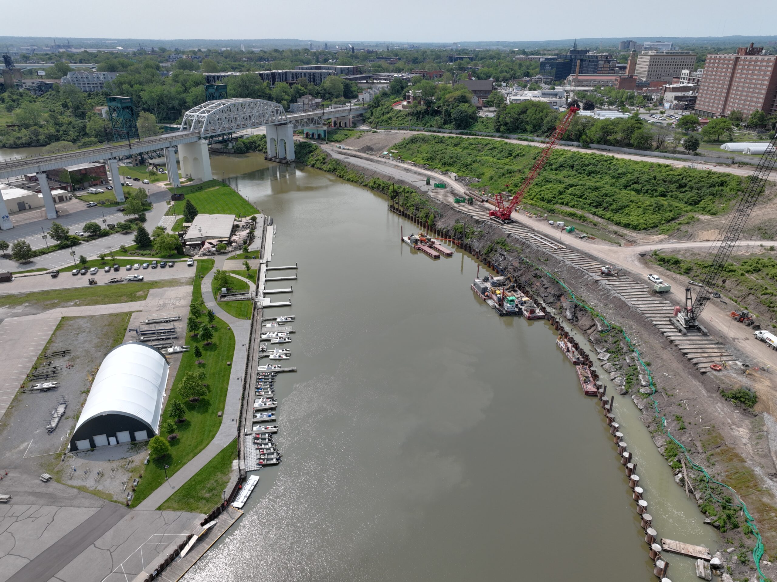
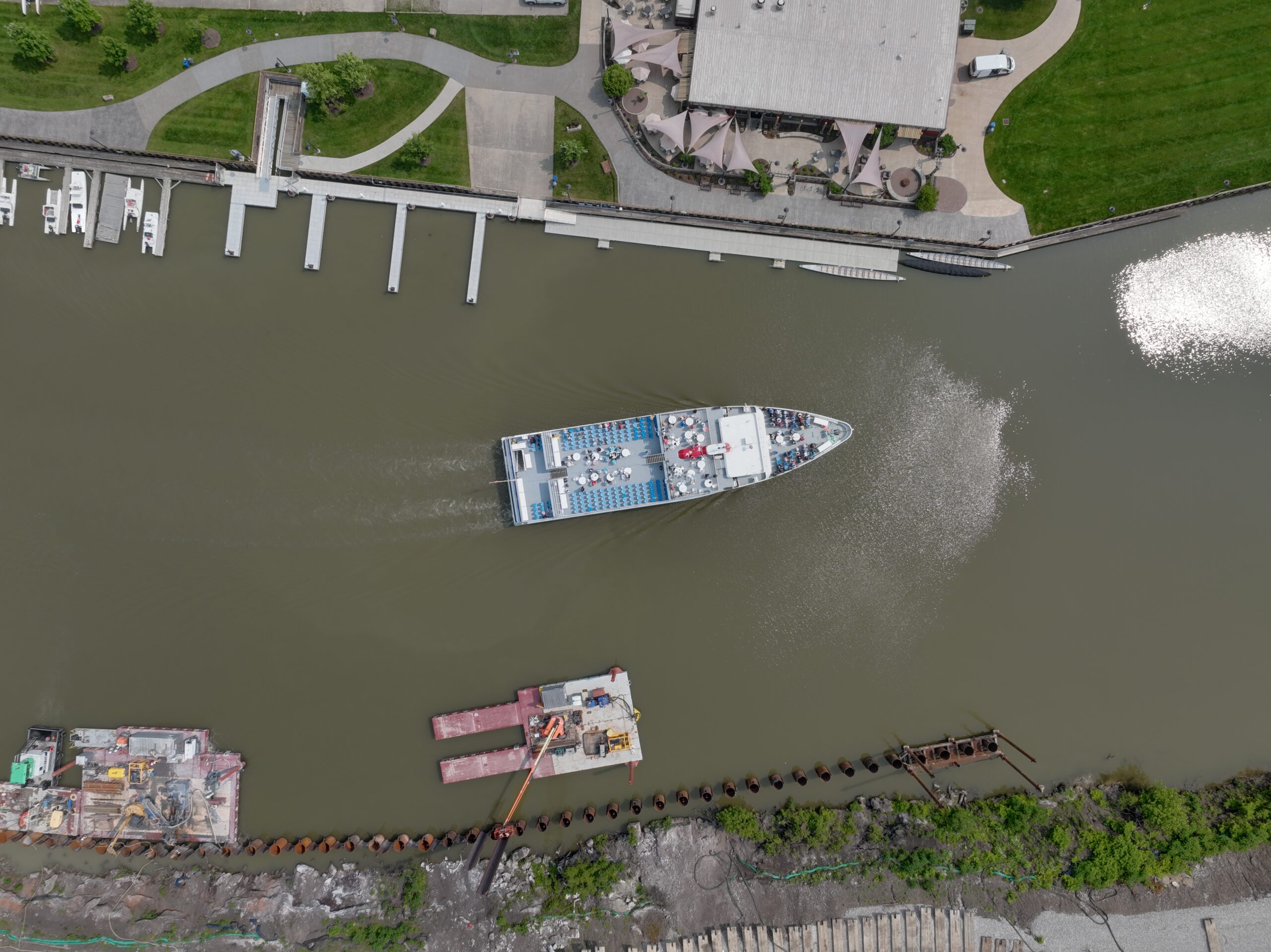
Irishtown Bend is an area within the City of Cleveland along the Cuyahoga River named for the Irish immigrants who once lived there. Without much-needed investment the hillside will fail, causing a disastrous collapse into the river and blocking all movement in both directions. Roads have already been closed due to movement and erosion of the hillside. New video and monitoring equipment shows the hillside continues to move, indicating that hillside stability continues to deteriorate. The eventual collapse will create a severe safety hazard and disrupt commerce — not just in Cleveland, but across the American Heartland, threatening manufacturing and mining industries and all the jobs they support.
Irishtown bend is $65 million stabilization project aimed at transforming the hillside that stretches from W. 25th street between the Superior Detroit Bridge and Columbus Road, into a 23-acre public park and community amenity, in total a $100 million project. Before the Park can become a reality, the Port of Cleveland is stabilizing the hillside. This crucial work will insure the Cuyahoga River remains a thriving waterway for both industry recreation.
Key Findings
- The economy could suffer nearly $7.07 billon annually should the river shut down due to hillside failure
- Over 24,000 jobs would be lost
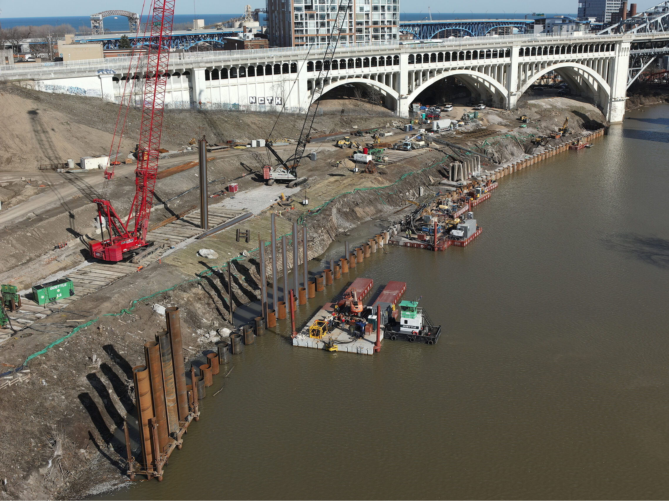
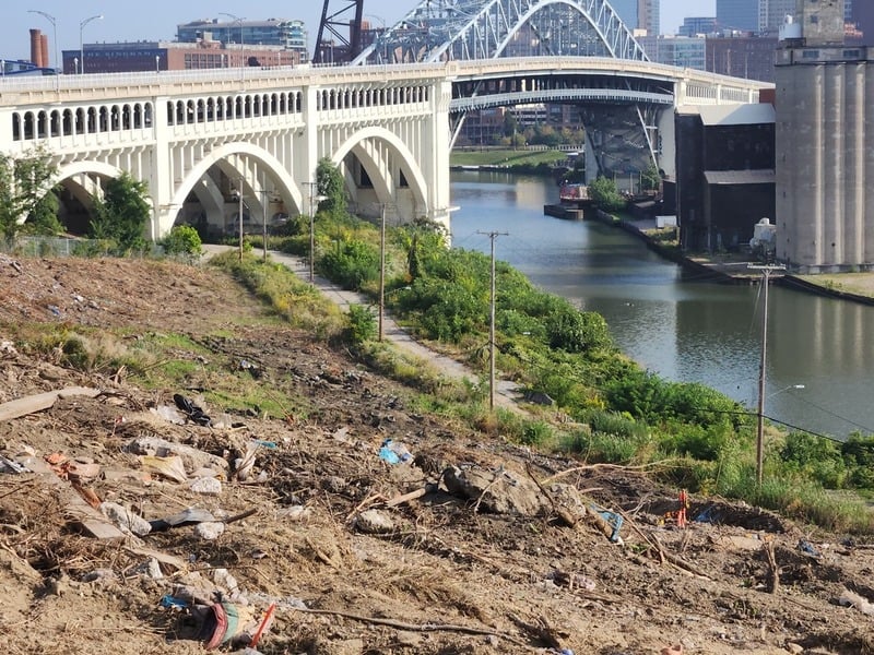
The Problem
- Geological: Deep weak clay layer
- Manmade: In the 1960s the USACE piled 200,000+ CY of material
The Risk
- Inclinometers show the hillside is moving
- Surface failures causing the closure of Riverbed Road
- Sewer line damaged and at risk
- Global failure of hillside is likely
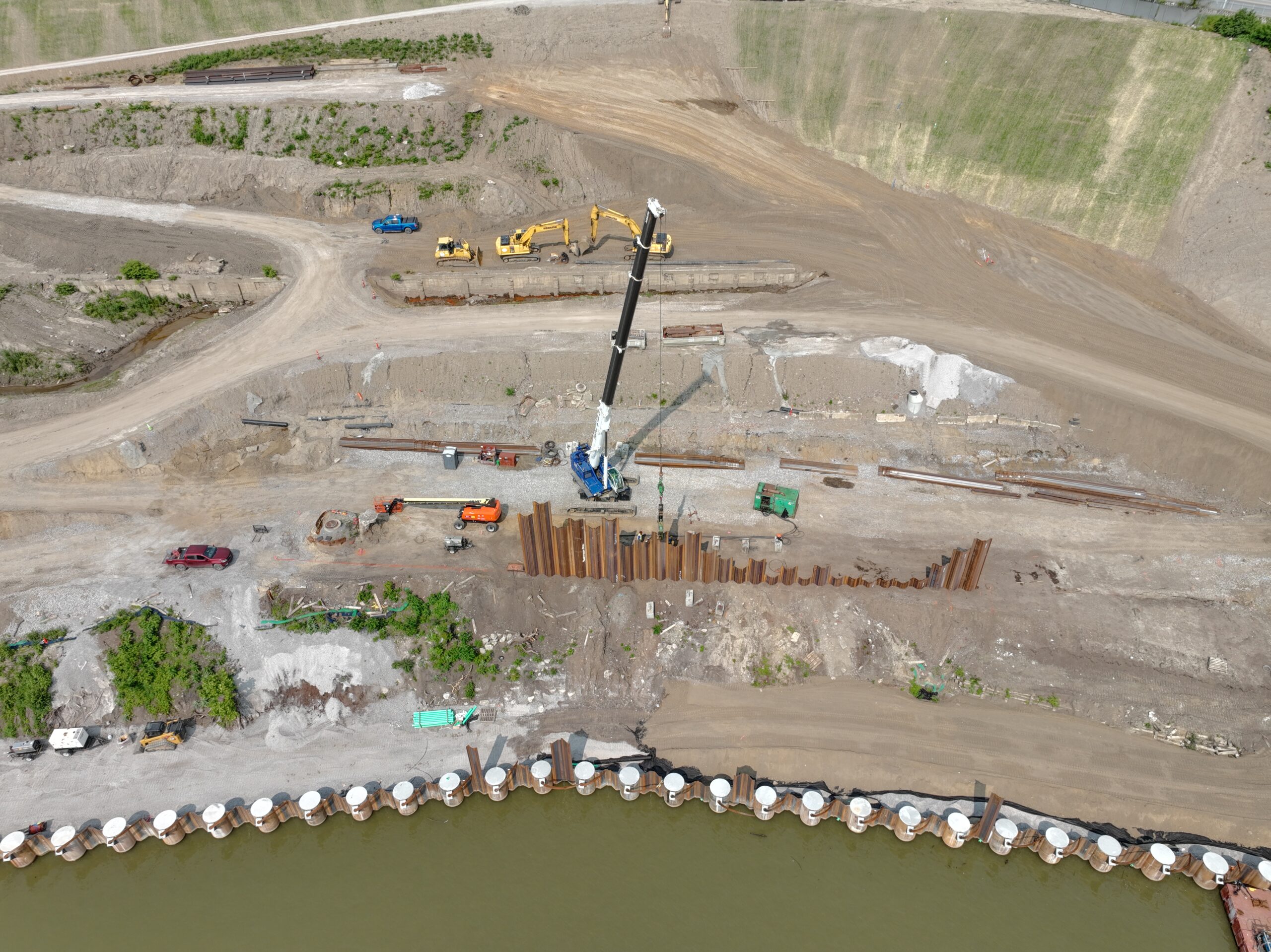
Goals & Objectives

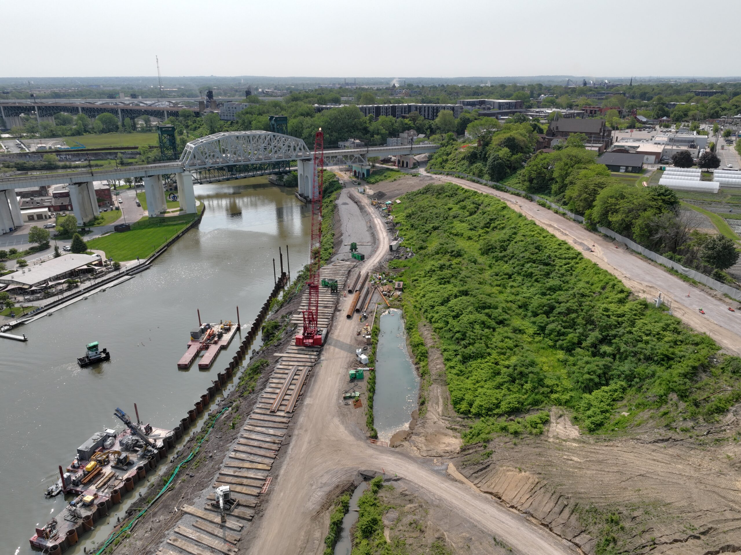
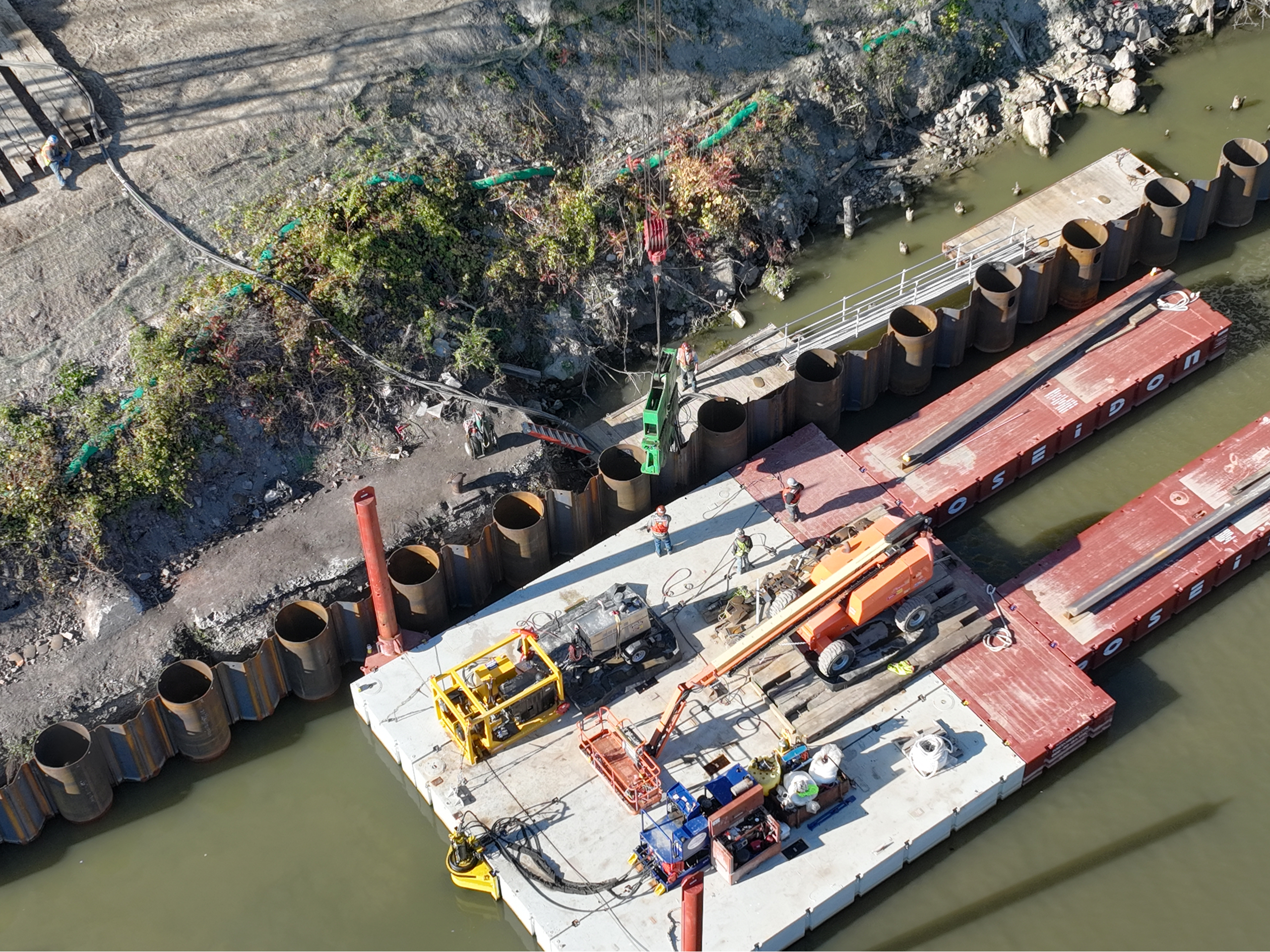
Stabilize Hillside
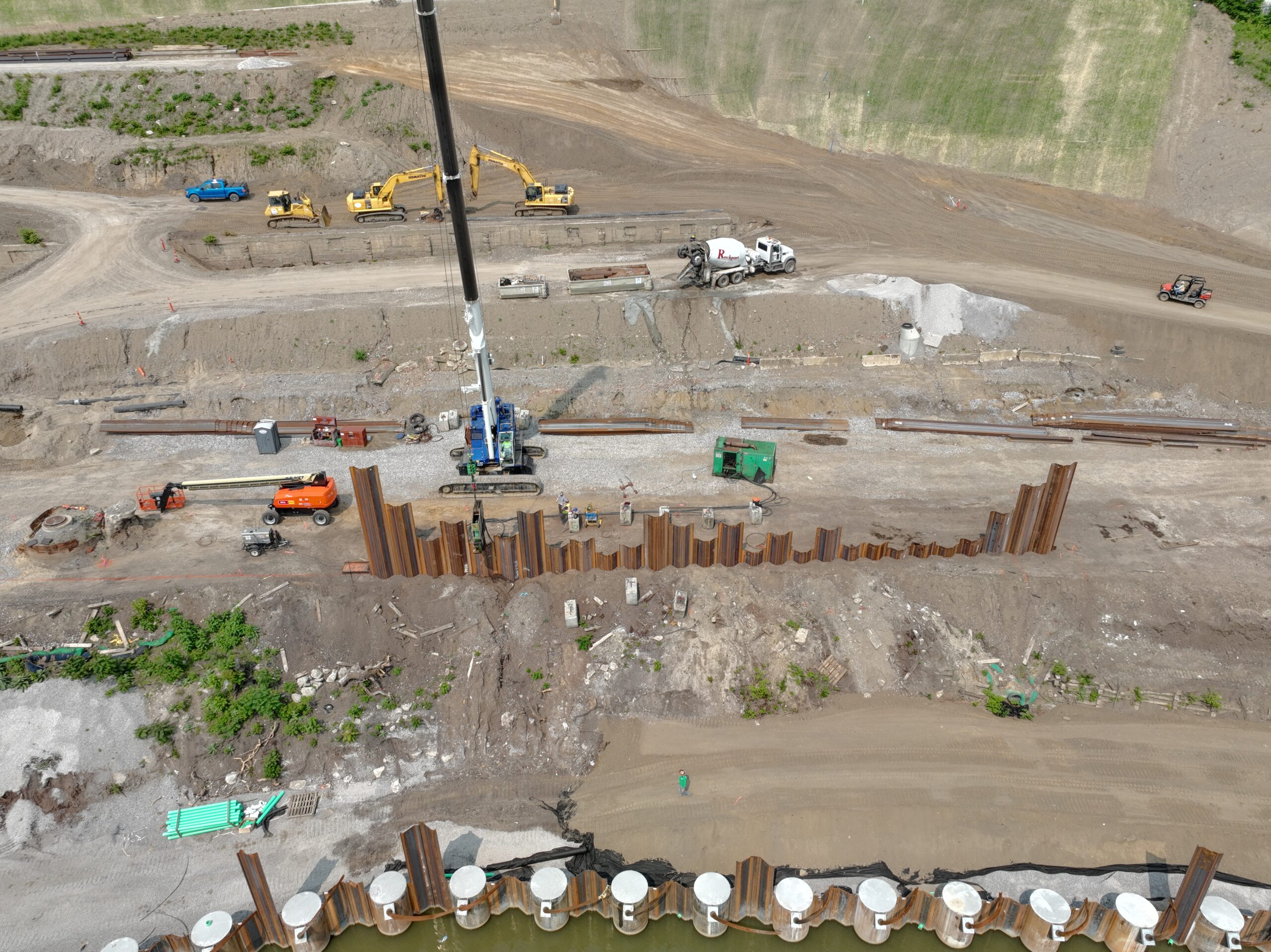
- Unload weight from fill that has been added over the last 60 years
- Building and replacing the deteriorated and dilapidated bulkhead/retaining wall
Improve Infrastructure
- Additional infrastructure improvements are needed
- Examples include: damaged sewer line repairs, realignment of a road, burying utilities, proper drainage, removal of invasive plant species, trails, etc.

Return Land to Public Use
- The future of Irishtown Bend includes proposed plans for a 17-acre park.
- A new park will attract residents and visitors from across the region and state.
Future Plans
The plans for Irishtown Bend Park elevate resident empowerment, collaboration, and equity considerations. The voice and vision of our community have shaped every aspect of the plans for this Park, which will bring together people, nature, industry, and history in an inclusive and accessible space. Partners from the public, private, and nonprofit sectors are working together to preserve riverfront land, enhance community health and connections, and establish the missing link between the 101-mile Ohio & Erie Canal Towpath Trail and Lake Erie.
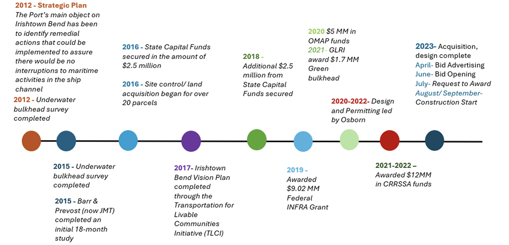
Timeline
Partners
- Northeast Ohio Regional Sewer District
- (NEORSD)
- Ohio Department of Transportation
- Ohio Department of Natural Resources
- City of Cleveland
- Cuyahoga County
- NOACA
- Land Studio
- Ohio City Inc.
- West Creek Conservancy
- Cleveland City Council
- Department of Transportation
- Cleveland Metroparks
- State of Ohio
- CleanOhio /Dept. of Public Works
- US Environmental Protection Agency
- Cleveland Metroparks
- Cuyahoga Metropolitan Housing Authority
- City of Cleveland
- Cuyahoga County
Photography